Flyability score
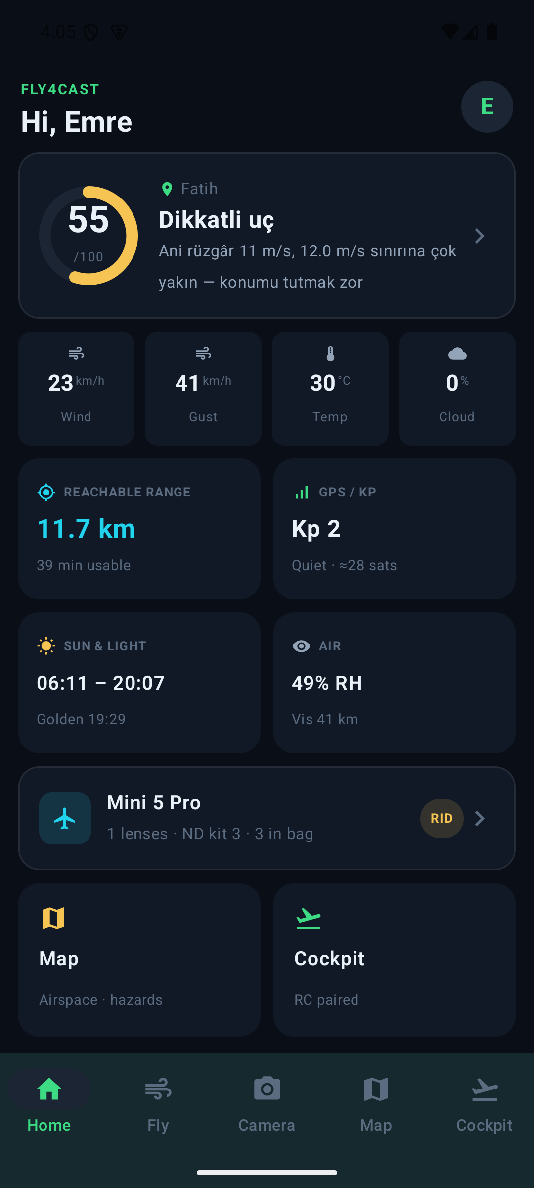
A conservative 0–100 go/caution/no-go from gust-vs-limit, precipitation, visibility, temperature and geomagnetic Kp — tuned to your exact drone.
Fly4cast fuses live weather, wind at altitude, airspace, live air traffic and exposure math into one cockpit — so every flight is a confident one. Built for pilots and photographers who don't guess.
One flyability score from wind, gust, airspace and your drone's own limits — no guessing.
DJI RC2 telemetry streams straight to your web cockpit — position, altitude, speed, signal and GPS, in real time.
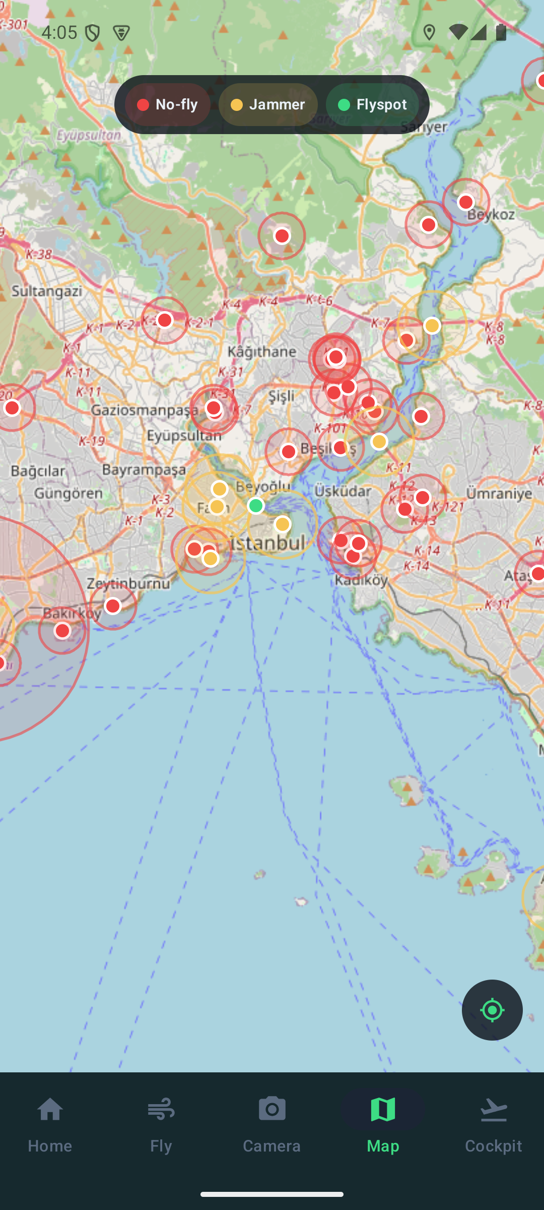
No-fly zones, GPS-jammer reports and community flyspots — on one live map.
The checks a professional runs before every flight — automated, cross-referenced and localised.
A conservative 0–100 go/caution/no-go from gust-vs-limit, precipitation, visibility, temperature and geomagnetic Kp — tuned to your exact drone.
A live wind radar from ground to 500 m, weighed against your drone's rated limit, with the 120 m legal ceiling marked.
Airports, heliports, restricted/military/CTR airspace and no-fly zones on one map, with proximity warnings before you take off.
Real ADS-B aircraft near your take-off point, altitude-coloured, with approach ETAs and destination when known.
Pilot-sourced GPS interference reports with confirmations — see and report jamming hotspots before they surprise you.
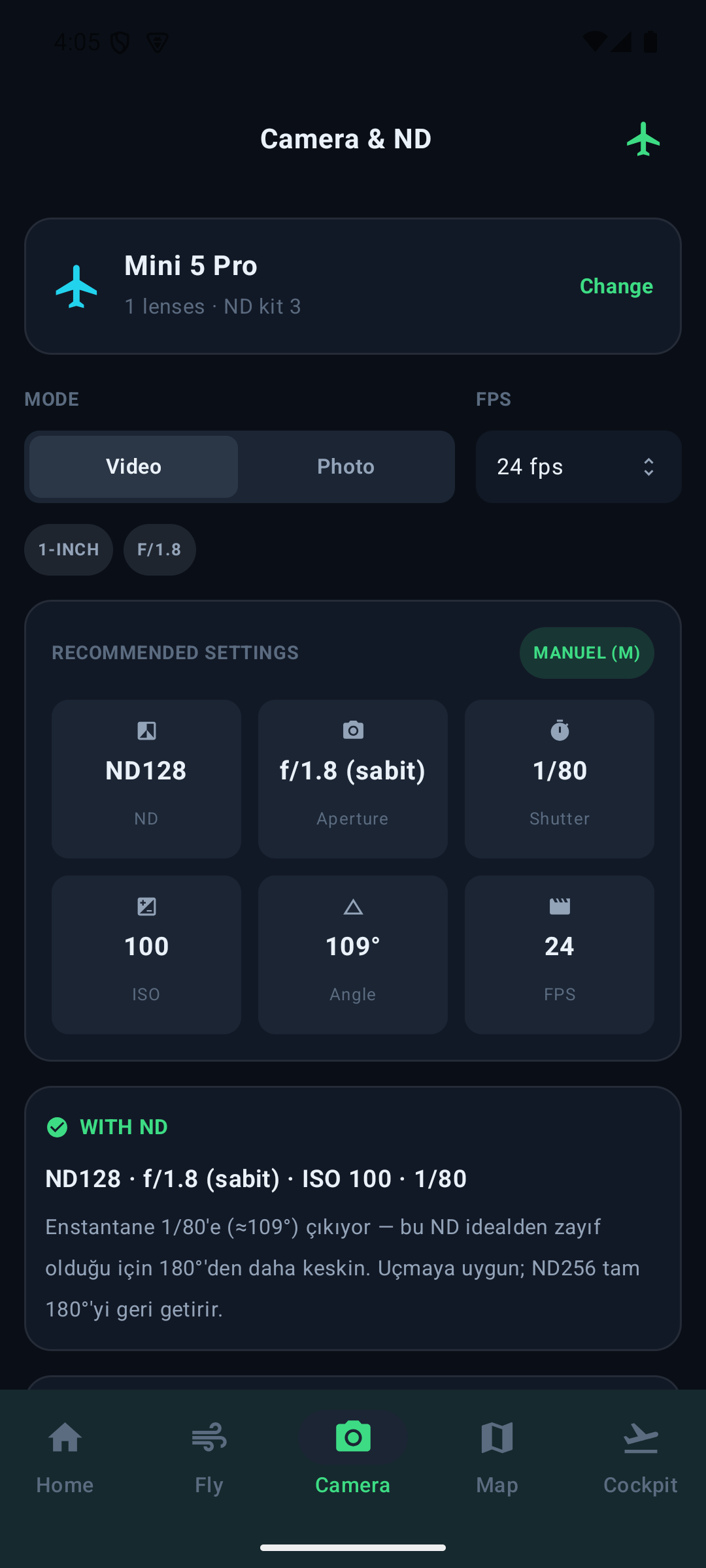
APEX/EV and the 180° shutter rule turned into per-lens camera and ND recommendations — from the exact filters in your bag.
Weather & flyability, the camera/ND advisor, the hazard map and a live cockpit for your DJI RC2 — on your phone, fully in sync with the web.
Two ways to fly, two paths through Fly4cast. Pick yours and walk the four steps.
Tap the map or use your location. Everything from here on is computed for that exact spot — not your city, not the nearest airport.
A 24-hour strip shows gust and precipitation at a glance. Choose an hour and the whole cockpit recalculates for it.
Thirteen criteria resolved in one panel. Problems rise to the top with the number and the limit; everything that passed collapses into a tidy row.
No-fly zones, restricted and military airspace, live ADS-B aircraft with approach times, and GPS-jammer reports from other pilots.
Add the drone you own and tick the ND filters actually in your bag — plus CPL and UV. Every recommendation comes only from what you have.
Golden and blue hour, sunrise and sunset at the true −0.833° horizon, ordered by what happens next with a live countdown.
Manual mode, ND, aperture, shutter, angle, ISO and a locked white balance — solved from the real light of the hour you picked.
If the perfect ND is not in your bag, both neighbours are solved and compared — with a reasoned pick so your footage stays clean.
Most apps hand you a verdict. Fly4cast shows the engineering behind it.
Not marketing copy — the things experienced pilots have learned the hard way, and the reasons each one is built into what we show you.
A steady 8 m/s is manageable. An 8 m/s average hiding 14 m/s gusts is what puts an aircraft into a tree. We weigh the gust against your drone's own rated resistance, not a generic threshold, because a 249 g Mini and a Mavic 3 do not live in the same wind.
Surface friction slows air near the earth. Climb to 120 m and the same day can be a different flight — often markedly stronger and shifted in direction. We model the whole column from ground to 500 m, so you know what is waiting up there before you commit.
Swap to a higher-capacity battery and you can quietly cross out of the sub-250 g class into registration and Remote ID territory. We track which battery you actually fly and tell you when the swap changes your legal footing.
Lithium cells lose usable voltage as temperature drops. The percentage on your screen stays optimistic while real capacity collapses, which is why cold-weather flyaways so often end as "it just fell". We factor temperature into the score and warn you to pre-warm packs.
Geomagnetic storms disturb the field your drone uses to hold heading and lock position. Most pilots never look at the Kp index; the ones who have had a toilet-bowl fly-away in an aurora event look at it forever. It sits in every score we calculate.
A 400 ft ceiling does not just threaten your airframe with moisture — it is the altitude at which you stop being able to see your aircraft. Losing sight of the drone is a rule violation in most of the world long before it becomes a safety event.
The sun's disc is still visible when its centre is already below the horizon, because the atmosphere bends light and the disc has width. Almanacs account for this; naive calculators do not. Our light windows use the true convention, which is why our times match your phone and your eyes.
Motion blur is not a defect — it is what makes movement read as natural rather than stuttering like a video game. Holding the right relationship between frame rate and exposure time is the single biggest difference between amateur and professional aerial video.
You can lift shadows and grade colour in post. You cannot remove the glare bouncing off water, wet foliage, glass or snow — that reflected light never carried the detail in the first place. This is the one filter with no digital substitute.
Flying out with a tailwind is effortless and deeply misleading. The binding constraint is always the return leg into wind, on a battery that is no longer fresh. We frame reachable distance around getting back, not around how far you can get.
Report and confirm GPS jammers, import your DJI flight logs, save your spots and manage your own airspace intelligence.
Mark GPS interference, confirm others' reports, and track the approval status of everything you've submitted.
Bring your flight history in and see it against the conditions of the day.
Add your own OpenAIP / data keys in account settings so your usage never hits a shared limit.
Grow the jammer & flyspot map with the pilots you fly with.
Start on the house. Upgrade when Fly4cast has earned a place in your pre-flight.
Straight answers, including the ones about our limits.
No, and nothing on it should be treated as one. Fly4cast is a planning aid that gathers the checks a careful pilot runs anyway. Official clearance comes from your national aviation authority, published NOTAMs and airspace charts — always confirm there before every flight.
Thirty-four DJI models across the Mini, Air, Mavic, Phantom, FPV, Avata, Neo and Inspire lines, including discontinued ones. Each carries its own rated wind resistance, flight time, cruise speed, sensor size, aperture range, Log profiles and factory ND kit — so recommendations differ per aircraft rather than being generic advice.
They are forecasts, so treat them as estimates with real uncertainty. Accuracy is strongest inside the next few hours and decays further out. That is exactly why we show a 24-hour strip rather than a single verdict — you can see the window opening and closing instead of trusting one number.
Because a wind that is a non-event for one aircraft is a no-go for another. A sub-250 g Mini and a Mavic 3 have very different rated wind resistance, cruise speed and battery endurance. Scoring against a generic threshold would be comfortable but wrong.
It describes how long the sensor is exposed relative to each frame. Around half the frame duration produces the motion blur audiences read as cinematic; far shorter makes movement look stuttery and artificial. It is the clearest single indicator of whether your video will feel professional.
ISO is already at its cleanest minimum in daylight, and closing the aperture too far softens the image through diffraction. An ND filter is the only lever that removes light without touching image quality or the shutter — which is what lets you keep cinematic motion in bright sun.
It measures geomagnetic disturbance. When it rises, GPS accuracy and compass reliability degrade — the conditions behind unexplained position drift and circling fly-aways. It is invisible in normal weather apps, which is precisely why we surface it.
Technically often yes, legally it depends entirely on your country, and practically it demands more of you: anti-collision lighting, maintained visual line of sight and far more conservative margins. We show you the light windows and flag drones with obstacle sensing that copes better after dark — the legal decision remains yours.
A no-fly zone is typically a fixed exclusion around infrastructure such as an airport or heliport. Restricted, danger and control zones are structured airspace with defined vertical limits and, often, conditional access. We show both, because being clear of one does not mean being clear of the other.
Yes — Fly4cast is global by design. Weather, wind at altitude, astronomy, live traffic and the camera engine work anywhere you can set a take-off point. Airspace coverage is worldwide, and adding your own free airspace key in account settings unlocks the richest layer for your region.
Pilots mark where they experienced interference, and others confirm or dispute it. Reports carry a severity, a confirmation count and an age, and every submission is reviewed. Treat them as community intelligence rather than official data — but interference is exactly the kind of hazard no official feed publishes.
We store what your account needs: email, a securely hashed password, your display name, language and plan, plus any API keys or flight logs you choose to add. Your take-off locations are used to compute your conditions. We do not sell personal data, and you can request deletion at any time.
Shared keys hit shared limits. Adding your own free key in account settings means your airspace and traffic lookups are yours alone — no queuing behind other users during busy periods, and richer coverage in some regions.
Every engine is unlocked during the launch period with no card required. When paid plans begin, the account you create now keeps working and you will be told well in advance — nothing you build up disappears.
If a term on this site is unfamiliar, it is defined here — no assumed knowledge.
Set your take-off point and read the sky in seconds.
Launch the app